Lunar Crater Detection and Depth Analysis
Deep Learning for Lunar Surface Analysis
Overview
This project leveraged deep learning techniques to detect craters on the lunar surface using satellite imagery from India's Chandrayaan-2 mission. It was built as part of a research initiative for lunar mapping and resulted in a publication in the Journal of the Indian Society of Remote Sensing.
Data Preparation
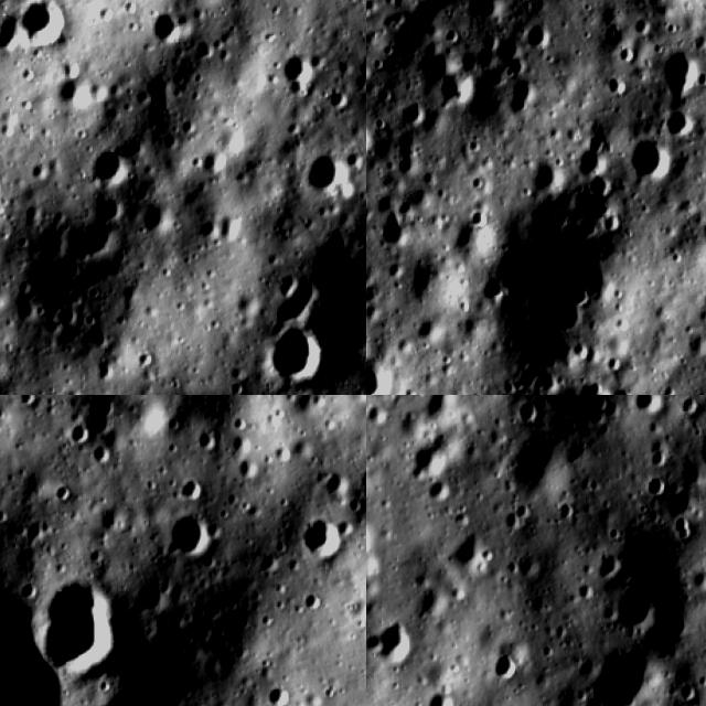
The imagery was captured by the Optical High Resolution Camera (OHRC) on Chandrayaan-2, covering areas of 12km x 3km with a ground resolution of 0.19m (19cm). Each image contained approximately 1 million pixels.
Given the enormous image size, we used the PDS4 (Planetary Data System) format to crop each image into smaller 640x640 pixel segments covering 120m x 120m each. Over 900+ images were manually labelled using RoboFlow.
Model Architecture
Two object detection models were trained:
- R-CNN for baseline crater detection
- YOLOv5 for faster, real-time capable detection
Both models were trained on Google Colab Pro to handle the computational requirements of the large dataset.
Geospatial Analysis
Beyond detection, we implemented a geospatial coordinate tracking and depth analysis algorithm to estimate the location and depth of detected craters. This information is critical for identifying potential landing spots on the lunar surface.
Results
- 85-92% detection accuracy on test datasets
- Successfully identified craters ranging from 10-100m in diameter
- Depth estimation based on crater diameter correlation
Challenges
The biggest challenge was manual labelling — some smaller craters (1-10m diameter) were missed during annotation. Since the research focused on suggesting landing spots, omitting sub-10m craters was acceptable. Techniques like oversampling and data augmentation were used to address underrepresentation of smaller features.
Outcome
Published in the Journal of the Indian Society of Remote Sensing — recognized as an innovative application of AI in space exploration.
comments